Field Data Collection Tool
2020 - byers.com

This screen shows the platform dashboard with all projects laid down on the map.
Product Context:
The client is an important technical services company in the telecommunications and utility industries. It has 1,000 employees deployed in providing outside and inside plant design, planning, project management, inspection, and right of way acquisition services, both wireline, and wireless, for RBOCs, ILECs, CLECs, IXCs, utilities, cable television companies, and commercial organizations throughout the United States. It also provides leading-edge AM/FM/GIS software, data conversion, mapping, and records services throughout the world.
The Challenge:
I helped the client with the design of an advanced web-based utility tool that manages field data collection projects in both remote and urban locations. It’s made for disconnected and connected data points in an easy to use, short lead time deployment scenario for locational accuracy and situational awareness.
Deliverables:
Ideation sketches
Studies
User flows
Wireframes
Low-fidelity prototype
Iterative updates design
Low fidelity prototype
High-fidelity prototypes
Motion design
Documentation
Design system

The creative process is complex and hard to define, but when ideas are generated, the simplest way of communicating them is by drawing.

Sometimes the best way to find the proper solution is to work on simple entities. Creating user flows and transforming them into simple wireframes is very useful in the designing process.
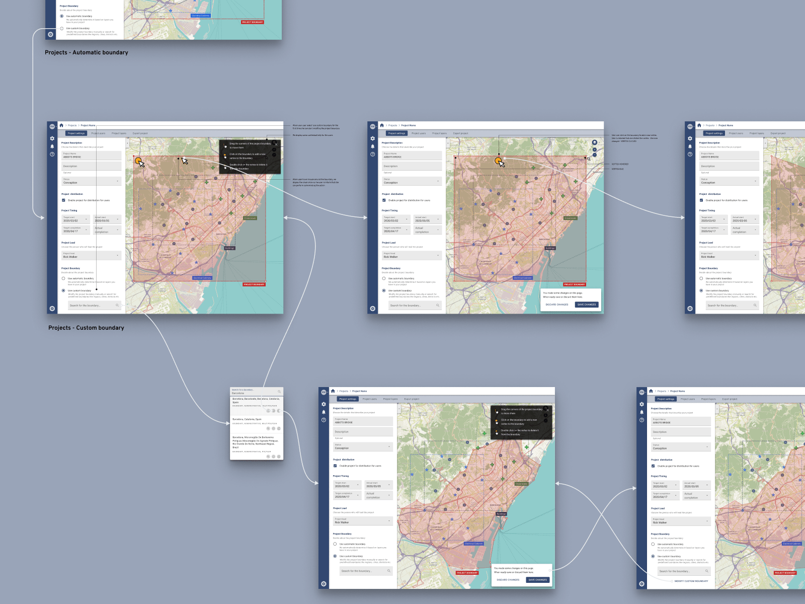
I divided the project into user flows and presented the design to stakeholders in this way. It makes it easier to comprehend and develop on the later stages of design to development process.
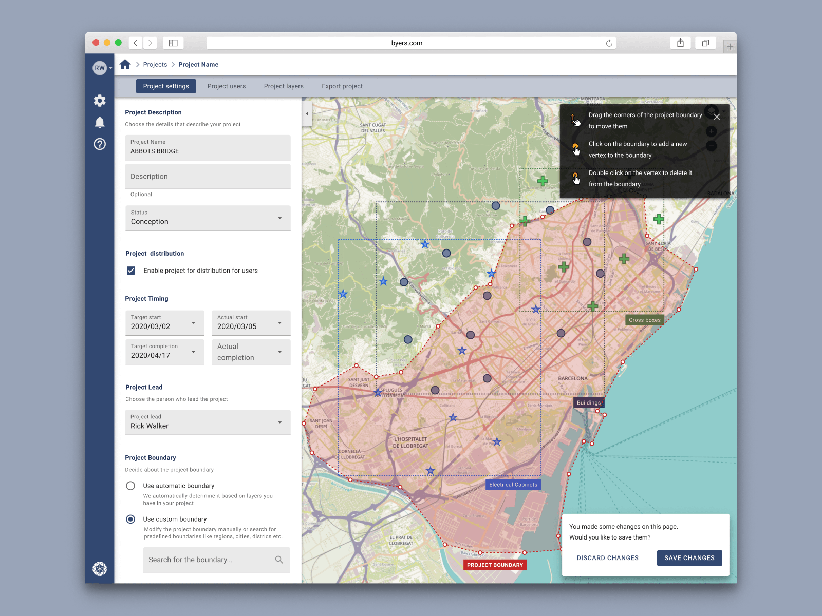
Project settings page.

I utilized the Google Material Design principles for the purpose of creating company design system.
I prototyped various elements of the user interface to check how people will interact with them.

I proposed a cohesive and coherent design and information architecture through the whole product.

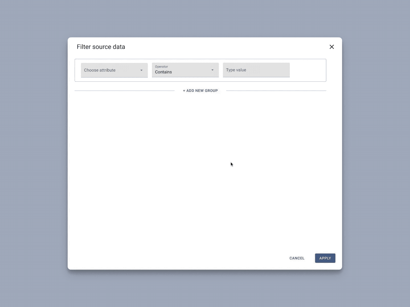
Design of the layer display page.